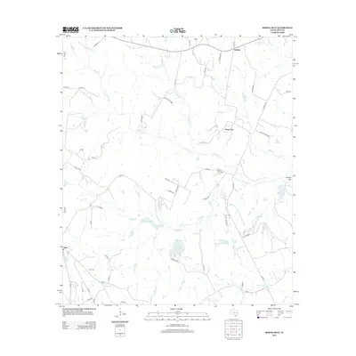
2013 Map of Spring Seat
USGS Topo · Published 2013About this map
The small community of Flynn anchors the southwestern corner of this Leon County landscape, where the local terrain is defined by the complex drainage of Boggy Cr and its many tributaries. The area is marked by numerous family-named water bodies and landmarks, including Easterling Lake, Simms Lake, and Hayden Mtn, suggesting a history of private landholdings and small-scale water management. Further north, the settlements of Spring Seat and Redland are linked by a network of rural county roads like Co RD 320 and Co RD 494. Genealogists will find several burial sites noted across the quadrangle, such as Flynn Cem, Spring Creek Cem, and Seale Cem, which provide tangible links to the early residents of this rural Texas region. The presence of features like Lake Reed and Keith Lake alongside seasonal creeks like Mustang Cr and Yellow Br illustrate a landscape shaped by intermittent water flow and agricultural endurance.
Find a feature on this map
67 named features on this map. Tap any name to fly to it.
Don’t see what you’re looking for? This feature index may not catch every label — zoom into the map to look around manually.
Map Details
Editions of this 2013 Spring Seat Map
This is the sole edition of this map. No revisions or reprints were ever made.
Other maps of this area

1953 · Palestine
USGS Topo · 1:250,000

1954 · Waco
USGS Topo · 1:250,000

1955 · Waco
USGS Topo · 1:250,000

1956 · Jewett
USGS Topo · 1:62,500

1957 · Palestine
USGS Topo · 1:250,000

1964 · Centerville
USGS Topo · 1:24,000

1964 · Spring Seat
USGS Topo · 1:24,000

1964 · Leona
USGS Topo · 1:24,000
1964 · Normangee
USGS Topo · 1:24,000
1964 · Hilltop Lakes
USGS Topo · 1:24,000