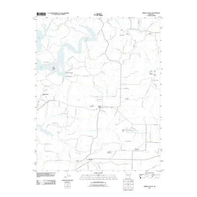
2011 Map of Spring Valley
USGS Topo · Published 2011About this map
Spring Valley sits at the heart of this landscape, where the headwaters of Whitener Branch and Brush Creek meet the rising terrain of Been Mountain and Vaughan Mountain. To the north, the waters of War Eagle Creek wind toward the expansive Beaver Lake, defining a region shaped by its rugged topography and river fords like Cook Ford and Sharp Ford. The map reveals a network of rural settlements, including Mayfield, Whitener, and Pilgrims Rest, connected by a web of local routes such as Plank Rd and Evans Logging Rd. Genealogists will find significant value in the numerous family-named burial grounds documented here, from the Johnson Cemetery near War Eagle Cove to the Vaughan Cemetery and Morriss Cemetery. The presence of the Hindsville Lake Dam on the eastern edge further illustrates the intersection of natural watercourses and 21st-century infrastructure.
Find a feature on this map
110 named features on this map. Tap any name to fly to it.
Don’t see what you’re looking for? This feature index may not catch every label — zoom into the map to look around manually.
Map Details
Editions of this 2011 Spring Valley Map
This is the sole edition of this map. No revisions or reprints were ever made.
Other maps of this area

1899 · Fayetteville
USGS Topo · 1:125,000

1900 · Eureka Springs
USGS Topo · 1:125,000

1901 · Eureka Springs
USGS Topo · 1:125,000

1901 · Fayetteville
USGS Topo · 1:125,000

1904 · Fayetteville
USGS Topo · 1:125,000

1945 · Harrison
USGS Topo · 1:250,000

1949 · Harrison
USGS Topo · 1:250,000

1954 · Harrison
USGS Topo · 1:250,000

1954 · Tulsa
USGS Topo · 1:250,000

1957 · Mundell
USGS Topo · 1:24,000