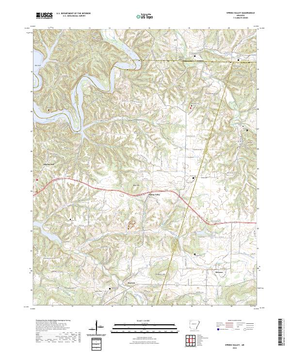
2024 Map of Spring Valley
USGS Topo · Published 2024About this map
Spring Valley and the surrounding Ozark uplands are defined by the winding course of War Eagle Creek, which feeds into the eastern reaches of Beaver Lake at the northern edge of this study. The landscape is dotted with small settlements like Mayfield and Whitener, often situated near water sources or along ridgelines. The mapping reveals a high density of ancestral burial grounds, including Austin Cem, Old Best Cem, and Burkshed Cem, which serve as vital markers for local family histories. These cemeteries are frequently located near named topographical features such as Vaughan Mtn and Been Mtn, illustrating a long-standing relationship between the community and the high ground. The road network, comprising numerous county routes like Co RD 757 and Co RD 4519, navigates through complex hollows such as Granny Hollow and Hickory Flat Hollow, highlighting the region's enduring rural character and the way historical travel routes have adapted to the challenging terrain.
Find a feature on this map
133 named features on this map. Tap any name to fly to it.
Don’t see what you’re looking for? This feature index may not catch every label — zoom into the map to look around manually.
Map Details
Editions of this 2024 Spring Valley Map
This is the sole edition of this map. No revisions or reprints were ever made.
Other maps of this area

1899 · Fayetteville
USGS Topo · 1:125,000

1900 · Eureka Springs
USGS Topo · 1:125,000

1901 · Eureka Springs
USGS Topo · 1:125,000

1901 · Fayetteville
USGS Topo · 1:125,000

1904 · Fayetteville
USGS Topo · 1:125,000

1945 · Harrison
USGS Topo · 1:250,000

1949 · Harrison
USGS Topo · 1:250,000

1954 · Harrison
USGS Topo · 1:250,000

1954 · Tulsa
USGS Topo · 1:250,000

1957 · Mundell
USGS Topo · 1:24,000