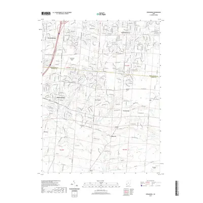
2019 Map of Springboro
USGS Topo · Published 2019About this map
Springboro and the neighboring southern reaches of Centerville anchor this landscape along the Montgomery Co and Warren Co line. This modern survey illustrates a suburbanized topography where residential development meets established aviation hubs like the Dayton-Wright Brothers Airport and Red Stewart Airfield. Despite the growth of the surrounding cities, the map preserves the locations of numerous historic burial grounds that speak to the area's agricultural past, including the Old School Baptist Cem near Ridgeville and the Salem-Reformed Church Cem west of Clear Cr.
Find a feature on this map
70 named features on this map. Tap any name to fly to it.
Don’t see what you’re looking for? This feature index may not catch every label — zoom into the map to look around manually.
Map Details
Editions of this 2019 Springboro Map
This is the sole edition of this map. No revisions or reprints were ever made.
Other maps of this area

1904 · Mason
USGS Topo · 1:62,500

1906 · Mason
USGS Topo · 1:62,500

1908 · Miamisburg
USGS Topo · 1:62,500

1913 · Waynesville
USGS Topo · 1:62,500

1914 · Morrow
USGS Topo · 1:62,500

1915 · Waynesville
USGS Topo · 1:62,500

1916 · Morrow
USGS Topo · 1:62,500

1951 · Franklin
USGS Topo · 1:24,000

1953 · Cincinnati
USGS Topo · 1:250,000

1955 · Monroe
USGS Topo · 1:24,000