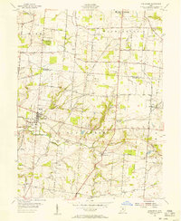
1955 Map of Springboro
USGS Topo · Published 1956About this map
The agrarian landscape of Clear Creek Township is documented here just before the mid-century expansion of nearby suburbs. Centered on the village of Springboro, the survey shows a network of family-named roads and rural infrastructure, including the Pumping Sta and a TV Relay Tower. Small settlements like Lytle, Ridgeville, and Kenricksville are clearly defined, often situated near crossroads or water features such as Clear Creek.
Find a feature on this map
66 named features on this map. Tap any name to fly to it.
Don’t see what you’re looking for? This feature index may not catch every label — zoom into the map to look around manually.
Map Details
Editions of this 1955 Springboro Map
This is the sole edition of this map. No revisions or reprints were ever made.
Other maps of this area

1904 · Mason
USGS Topo · 1:62,500

1906 · Mason
USGS Topo · 1:62,500

1908 · Miamisburg
USGS Topo · 1:62,500

1913 · Waynesville
USGS Topo · 1:62,500

1914 · Morrow
USGS Topo · 1:62,500

1915 · Waynesville
USGS Topo · 1:62,500

1916 · Morrow
USGS Topo · 1:62,500

1951 · Franklin
USGS Topo · 1:24,000

1953 · Cincinnati
USGS Topo · 1:250,000

1955 · Monroe
USGS Topo · 1:24,000