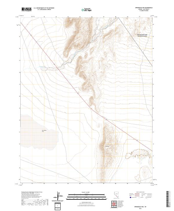
2021 Map of Springdale NW
USGS Topo · Published 2021About this map
Sarcobatus Flat dominates the southwestern portion of this desert landscape, illustrating the characteristic basin-and-range topography of southern Nevada. The terrain is defined by dramatic elevation shifts, rising from the flat alluvial basin toward the heights of Coba Mtn in the southeastern quadrant. This arid environment is marked by drainage patterns like Tolicha Wash, which cuts across the northern and central sections of the survey. The isolation of the area is underscored by the sparse modern infrastructure, consisting primarily of the north-south corridor of Route 95. The map provides a detailed look at the Public Land Survey System grid, documenting the township and range divisions that delineate this part of the Mojave Desert ecosystem.
Find a feature on this map
10 named features on this map. Tap any name to fly to it.
Don’t see what you’re looking for? This feature index may not catch every label — zoom into the map to look around manually.
Map Details
Editions of this 2021 Springdale NW Map
This is the sole edition of this map. No revisions or reprints were ever made.
Other maps of this area

1908 · Kawich
USGS Topo · 1:250,000

1908 · Lida
USGS Topo · 1:250,000

1913 · Lida
USGS Topo · 1:250,000

1942 · Tolicha Peak
USGS Topo · 1:125,000

1954 · Goldfield
USGS Topo · 1:250,000

1955 · Goldfield
USGS Topo · 1:250,000

1958 · Goldfield
USGS Topo · 1:250,000

1962 · Goldfield
USGS Topo · 1:250,000
1966 · Springdale
USGS Topo · 1:62,500
1967 · Bonnie Claire SE
USGS Topo · 1:24,000