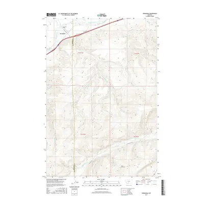
2017 Map of Springdale
USGS Topo · Published 2017About this map
The Springdale settlement serves as the focal point of this northern Montana landscape, situated where the Springdale Bridge crosses the Yellowstone River. The topography is defined by a dense network of drainages including Mendenhall Cr, Jarrett Cr, and Chicken Cr, which flow through the high ground between the Yellowstone and the West Boulder River to the south. The map documents the boundary between Park County and Sweet Grass County, illustrating how political borders intersect with physical landmarks like the Coal Mine Rim. Transport corridors follow the natural contours of the river valley, with Frontage Rd and the more evocatively named Convict Grade Rd providing local access. To the south, Main Boulder Rd and W Boulder Rd provide the primary route through the varied terrain of the West Boulder drainage.
Find a feature on this map
24 named features on this map. Tap any name to fly to it.
Don’t see what you’re looking for? This feature index may not catch every label — zoom into the map to look around manually.
Map Details
Editions of this 2017 Springdale Map
This is the sole edition of this map. No revisions or reprints were ever made.
Other maps of this area

1891 · Livingston
USGS Topo · 1:250,000

1893 · Livingston
USGS Topo · 1:250,000

1947 · Bozeman
USGS Topo · 1:250,000

1948 · Bozeman
USGS Topo · 1:250,000

1951 · Mount Rae
USGS Topo · 1:24,000

1951 · Squaw Peak
USGS Topo · 1:24,000

1951 · Kelly Hills
USGS Topo · 1:24,000

1951 · Springdale
USGS Topo · 1:24,000

1951 · Mc Leod Basin
USGS Topo · 1:24,000

1951 · Hunters Hot Springs
USGS Topo · 1:24,000