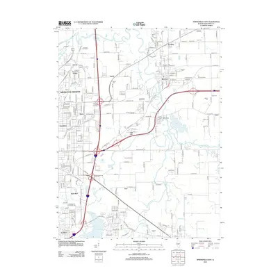
2012 Map of Springfield East
USGS Topo · Published 2012About this map
The Sangamon River meanders through this landscape east of Illinois' state capital, framing a region defined by its memorials and suburban growth. The significant grounds of the Camp Butler National Cem and Roselawn Memorial Park Cem occupy the central portion of the map, highlighting the area's role as a site of remembrance. To the south, the waters of Lake Springfield reach toward settlements like Southlawn and Shale Bluff, while the S Fork Sangamon River joins the main branch near Riverton. The infrastructure of the early 21st century is evident in the Sangamon Avenue Interchange and local airstrips like Stanton Airport. This survey provides a clear view of the transition from the developed outskirts of Arlington Heights and Grandview to the more open lands surrounding Barclay and Derry Farm.
Find a feature on this map
72 named features on this map. Tap any name to fly to it.
Don’t see what you’re looking for? This feature index may not catch every label — zoom into the map to look around manually.
Map Details
Editions of this 2012 Springfield East Map
This is the sole edition of this map. No revisions or reprints were ever made.
Other maps of this area

1907 · Springfield
USGS Topo · 1:62,500

1922 · Divernon
USGS Topo · 1:62,500

1923 · Taylorville
USGS Topo · 1:62,500

1924 · Divernon
USGS Topo · 1:62,500

1925 · Taylorville
USGS Topo · 1:62,500

1930 · Springfield
USGS Topo · 1:62,500

1940 · Springfield
USGS Topo · 1:62,500

1950 · Springfield West
USGS Topo · 1:24,000

1950 · Springfield East
USGS Topo · 1:24,000

1954 · Mechanicsburg
USGS Topo · 1:62,500