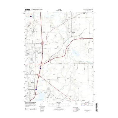
2015 Map of Springfield East
USGS Topo · Published 2015About this map
The Sangamon River snakes through the northern portion of this landscape, separating the village of Riverton from the outlying residential developments of Spaulding and Bissell. This 2015 survey reveals the established infrastructure of Illinois' capital region, where industrial markers like Shaft Pond near the riverbanks contrast with the preserved green space of Carpenter Park. The map documents a high density of burial grounds essential for genealogical research, including the Ladysmith Cem, Taylor Cem, and the expansive Roselawn Memorial Park Cem. To the south, the terrain transitions toward the South Fork Sangamon River and the northern reaches of Lake Springfield, passing through the suburban and semi-rural communities of Rochester, Keys, and Shale Bluff. Transportation networks are dominated by the highway corridors that intersect near Arlington Heights and Grandview, while Stanton Airport remains a notable landmark on the eastern edge of the quadrangle.
Find a feature on this map
207 named features on this map. Tap any name to fly to it.
Don’t see what you’re looking for? This feature index may not catch every label — zoom into the map to look around manually.
Map Details
Editions of this 2015 Springfield East Map
This is the sole edition of this map. No revisions or reprints were ever made.
Other maps of this area

1907 · Springfield
USGS Topo · 1:62,500

1922 · Divernon
USGS Topo · 1:62,500

1923 · Taylorville
USGS Topo · 1:62,500

1924 · Divernon
USGS Topo · 1:62,500

1925 · Taylorville
USGS Topo · 1:62,500

1930 · Springfield
USGS Topo · 1:62,500

1940 · Springfield
USGS Topo · 1:62,500

1950 · Springfield West
USGS Topo · 1:24,000

1950 · Springfield East
USGS Topo · 1:24,000

1954 · Mechanicsburg
USGS Topo · 1:62,500