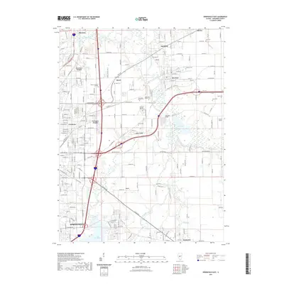
2021 Map of Springfield East
USGS Topo · Published 2021About this map
The Sangamon River and its South Fork anchor the landscape east of the Illinois state capital, where suburban growth meets the rural heritage of Sangamon County. This 2021 update documents the corridor between Springfield and Rochester, illustrating the modern infrastructure of Interstate 55 and US Hwy 36 alongside historic routes like Old Rte 36. Significant memorial sites are prominent, most notably the Camp Butler National Cem and Camp Butler Memorial National Cem situated near the riverbanks.
Find a feature on this map
49 named features on this map. Tap any name to fly to it.
Don’t see what you’re looking for? This feature index may not catch every label — zoom into the map to look around manually.
Map Details
Editions of this 2021 Springfield East Map
This is the sole edition of this map. No revisions or reprints were ever made.
Other maps of this area

1907 · Springfield
USGS Topo · 1:62,500

1922 · Divernon
USGS Topo · 1:62,500

1923 · Taylorville
USGS Topo · 1:62,500

1924 · Divernon
USGS Topo · 1:62,500

1925 · Taylorville
USGS Topo · 1:62,500

1930 · Springfield
USGS Topo · 1:62,500

1940 · Springfield
USGS Topo · 1:62,500

1950 · Springfield West
USGS Topo · 1:24,000

1950 · Springfield East
USGS Topo · 1:24,000

1954 · Mechanicsburg
USGS Topo · 1:62,500