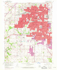
1960 Map of Springfield
USGS Topo · Published 1971About this map
The Springfield city center and its western expansion dominate this mid-century landscape, showing a period of significant growth between the original 1960 field check and 1970 revisions. Education and institutional land use are prominent, with large campuses for Drury College, Evangel College, and the Federal Medical Center. The urban fabric is dense with local history, featuring numerous neighborhood schools such as Reed Jr High Sch and Pipkin Jr High Sch, alongside spiritual landmarks like St De Chantel Academy.
Find a feature on this map
85 named features on this map. Tap any name to fly to it.
Don’t see what you’re looking for? This feature index may not catch every label — zoom into the map to look around manually.
Map Details
Editions of this 1960 Springfield Map
4 editions found
Other maps of this area

1884 · Springfield
USGS Topo · 1:125,000

1886 · Springfield
USGS Topo · 1:125,000

1935 · Springfield
USGS Topo · 1:24,000

1936 · Brookline
USGS Topo · 1:24,000

1937 · Galloway
USGS Topo · 1:24,000

1937 · Ozark
USGS Topo · 1:48,000

1943 · Ozark
USGS Topo · 1:62,500

1945 · Ozark
USGS Topo · 1:62,500

1946 · Bassville
USGS Topo · 1:24,000

1947 · Strafford
USGS Topo · 1:62,500