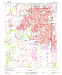
1960 Map of Springfield
USGS Topo · Published 1976About this map
Springfield's mid-century expansion is documented here through a dense network of civic, educational, and medical institutions. The urban core is anchored by Southwest Missouri State University and Drury College, while specialized facilities like the Federal Medical Center and St De Chantel Academy reflect the city's role as a regional hub. To the west, the smaller community of Nichols and the Springfield Mun Airport define the outskirts, while the southern reaches show the early footprints of major developments like the Battlefield Mall Shopping Center and Parkcrest Village Shopping Center.
Find a feature on this map
94 named features on this map. Tap any name to fly to it.
Don’t see what you’re looking for? This feature index may not catch every label — zoom into the map to look around manually.
Map Details
Editions of this 1960 Springfield Map
4 editions found
Other maps of this area

1884 · Springfield
USGS Topo · 1:125,000

1886 · Springfield
USGS Topo · 1:125,000

1935 · Springfield
USGS Topo · 1:24,000

1936 · Brookline
USGS Topo · 1:24,000

1937 · Galloway
USGS Topo · 1:24,000

1937 · Ozark
USGS Topo · 1:48,000

1943 · Ozark
USGS Topo · 1:62,500

1945 · Ozark
USGS Topo · 1:62,500

1946 · Bassville
USGS Topo · 1:24,000

1947 · Strafford
USGS Topo · 1:62,500