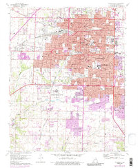
1960 Map of Springfield
USGS Topo · Published 1986About this map
Springfield's mid-century expansion is documented in this detailed study, where the intersection of the St Louis San Francisco and Missouri Pacific railroads anchors the city's industrial and residential core. The map highlights a robust institutional landscape, featuring Southwest Missouri State University, Drury College, and the sprawling Federal Medical Center south of the city center. To the west, the rail junction at Nichols marks a point of historical transit, while the presence of Springfield National Cemetery and Hazelwood Cemetery provide significant points of interest for genealogists. The urban fabric is punctuated by numerous neighborhood schools like McDaniel School and Rountree School, reflecting the post-war growth within the townships of North Campbell and Wilson. Waterways such as Wilson Creek and Jordan Creek wind through the city, connecting various green spaces like Fassnight Park and Phelps Grove Park.
Find a feature on this map
80 named features on this map. Tap any name to fly to it.
Don’t see what you’re looking for? This feature index may not catch every label — zoom into the map to look around manually.
Map Details
Editions of this 1960 Springfield Map
4 editions found
Other maps of this area

1884 · Springfield
USGS Topo · 1:125,000

1886 · Springfield
USGS Topo · 1:125,000

1935 · Springfield
USGS Topo · 1:24,000

1936 · Brookline
USGS Topo · 1:24,000

1937 · Galloway
USGS Topo · 1:24,000

1937 · Ozark
USGS Topo · 1:48,000

1943 · Ozark
USGS Topo · 1:62,500

1945 · Ozark
USGS Topo · 1:62,500

1946 · Bassville
USGS Topo · 1:24,000

1947 · Strafford
USGS Topo · 1:62,500