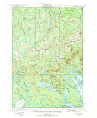
1931 Map of Springfield
USGS Topo · Published 1970About this map
Springfield and Prentiss serve as the primary hubs in this corner of Penobscot County during the early 1930s. The landscape is defined by a series of prominent ridges, including Tucker Ridge, Tar Ridge, and Cushman Ridge, which dictated the placement of homesteads and early roadways. The abundance of community schoolhouses, such as Thompson Sch, Webster Sch, Tolman Sch, and Mc Kinney Sch, reveals a distributed rural population tied to the land.
Find a feature on this map
138 named features on this map. Tap any name to fly to it.
Don’t see what you’re looking for? This feature index may not catch every label — zoom into the map to look around manually.
Map Details
Editions of this 1931 Springfield Map
4 editions found
Other maps of this area

1920 · Winn
USGS Topo · 1:62,500

1931 · Springfield
USGS Topo · 1:48,000

1931 · Saponac
USGS Topo · 1:48,000

1932 · Nicatous Lake
USGS Topo · 1:48,000

1934 · Saponac
USGS Topo · 1:62,500

1934 · Nicatous Lake
USGS Topo · 1:62,500

1934 · Springfield
USGS Topo · 1:62,500

1940 · Danforth
USGS Topo · 1:62,500

1940 · Mattawamkeag
USGS Topo · 1:62,500

1941 · Danforth
USGS Topo · 1:62,500