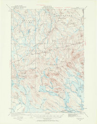
1931 Map of Springfield
USGS Topo · Published 1970About this map
Springfield and Carroll define the settled corridors of this Penobscot County interior during the early 1930s. The landscape is a network of small family school districts, including the Webster Sch, Tolman Sch, and Gates Sch, which served remote homesteads like the Drake Place and Budge Farm. This map reveals a transition from the structured township divisions of Prentiss to the more water-dominated terrain of the south, where the Passadumkeag River snakes through the 1000 Acre Heath. Significant water bodies such as Upper Sysladobsis Lake, Bottle Lake, and Junior Lake are detailed with their distinct coves and islands, including Boyce Cove and Dollar I. The presence of a Fire Tower on Dill Ridge highlights the era's focus on forest management across the numerous ridges like Cushman Ridge and Kirkland Ridge.
Find a feature on this map
130 named features on this map. Tap any name to fly to it.
Don’t see what you’re looking for? This feature index may not catch every label — zoom into the map to look around manually.
Map Details
Editions of this 1931 Springfield Map
4 editions found
Other maps of this area

1920 · Winn
USGS Topo · 1:62,500

1931 · Springfield
USGS Topo · 1:48,000

1931 · Saponac
USGS Topo · 1:48,000

1932 · Nicatous Lake
USGS Topo · 1:48,000

1934 · Saponac
USGS Topo · 1:62,500

1934 · Nicatous Lake
USGS Topo · 1:62,500

1934 · Springfield
USGS Topo · 1:62,500

1940 · Danforth
USGS Topo · 1:62,500

1940 · Mattawamkeag
USGS Topo · 1:62,500

1941 · Danforth
USGS Topo · 1:62,500