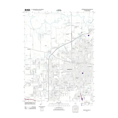
2012 Map of Springfield West
USGS Topo · Published 2012About this map
Springfield and its western suburbs are detailed here just after the turn of the 21st century, showing the dense intersection of state history and modern infrastructure. The landscape is shaped by significant historical sites, including Oak Ridge Cem and the adjacent Camp Lincoln. The state's political and cultural identity is represented by the Illinois State Fairground and the Thomas Rees Memorial Carillon located near the heart of the city.
Find a feature on this map
92 named features on this map. Tap any name to fly to it.
Don’t see what you’re looking for? This feature index may not catch every label — zoom into the map to look around manually.
Map Details
Editions of this 2012 Springfield West Map
This is the sole edition of this map. No revisions or reprints were ever made.
Other maps of this area

1907 · Springfield
USGS Topo · 1:62,500

1909 · Tallula
USGS Topo · 1:62,500

1922 · Divernon
USGS Topo · 1:62,500

1924 · Divernon
USGS Topo · 1:62,500

1924 · Waverly
USGS Topo · 1:62,500

1926 · Waverly
USGS Topo · 1:62,500

1930 · Springfield
USGS Topo · 1:62,500

1940 · Tallula
USGS Topo · 1:62,500

1940 · Springfield
USGS Topo · 1:62,500

1950 · Springfield West
USGS Topo · 1:24,000