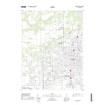
2018 Map of Springfield West
USGS Topo · Published 2018About this map
Springfield and its western suburbs are detailed here, centered on the legacy of the sixteenth president and the state's seat of government. Significant historical landmarks are documented throughout the urban grid, most notably the Lincoln Tomb within the grounds of Oak Ridge Cem and the Lincoln Home National Historic Site downtown. The landscape is defined by the winding Sangamon River to the north and the expansive Abraham Lincoln Capital Airport, which sits adjacent to the NG Springfield (TS Camp Lincoln) military installation.
Find a feature on this map
143 named features on this map. Tap any name to fly to it.
Don’t see what you’re looking for? This feature index may not catch every label — zoom into the map to look around manually.
Map Details
Editions of this 2018 Springfield West Map
This is the sole edition of this map. No revisions or reprints were ever made.
Other maps of this area

1907 · Springfield
USGS Topo · 1:62,500

1909 · Tallula
USGS Topo · 1:62,500

1922 · Divernon
USGS Topo · 1:62,500

1924 · Divernon
USGS Topo · 1:62,500

1924 · Waverly
USGS Topo · 1:62,500

1926 · Waverly
USGS Topo · 1:62,500

1930 · Springfield
USGS Topo · 1:62,500

1940 · Tallula
USGS Topo · 1:62,500

1940 · Springfield
USGS Topo · 1:62,500

1950 · Springfield West
USGS Topo · 1:24,000