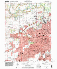
1998 Map of Springfield West
USGS Topo · Published 2000About this map
The Illinois state capital is captured in high detail at the close of the twentieth century, showing a dense grid of civic and residential growth expanding westward. The State Capitol and surrounding government buildings, including the Armory and Post Office, form the city’s core. To the north, the sprawling grounds of Oak Ridge Cemetery hold the Lincoln Tomb, while the massive State Fairgrounds and the military outpost at Camp Lincoln define the northern edge of development.
Find a feature on this map
124 named features on this map. Tap any name to fly to it.
Don’t see what you’re looking for? This feature index may not catch every label — zoom into the map to look around manually.
Map Details
Editions of this 1998 Springfield West Map
This is the sole edition of this map. No revisions or reprints were ever made.
Other maps of this area

1907 · Springfield
USGS Topo · 1:62,500

1909 · Tallula
USGS Topo · 1:62,500

1922 · Divernon
USGS Topo · 1:62,500

1924 · Divernon
USGS Topo · 1:62,500

1924 · Waverly
USGS Topo · 1:62,500

1926 · Waverly
USGS Topo · 1:62,500

1930 · Springfield
USGS Topo · 1:62,500

1940 · Tallula
USGS Topo · 1:62,500

1940 · Springfield
USGS Topo · 1:62,500

1950 · Springfield West
USGS Topo · 1:24,000