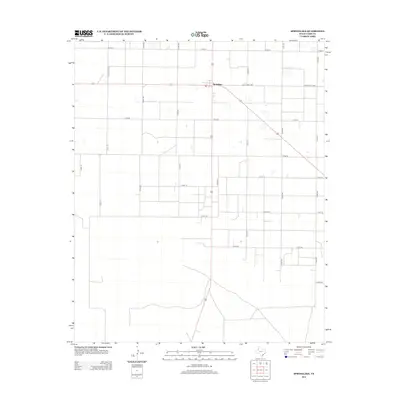
2012 Map of Springlake
USGS Topo · Published 2012About this map
Springlake serves as the central hub of this agricultural landscape in Lamb County, where the rigid geometry of the Texas High Plains is defined by an extensive grid of section roads. The settlement is situated at the intersection of several key routes, including Ranch Road 2080 and Co Rd-211, reflecting a community organized around the efficiency of large-scale ranching and farming operations. The map reveals a land divided into precise quadrants by a network of numbered county roads, such as Co Rd-120 and Co Rd-74, which facilitate movement across the flat Llano Estacado terrain. Small, seasonal water bodies or depressions are scattered throughout the northern sections, particularly near Ranch Road 302, providing a subtle contrast to the otherwise man-made linearity of the region's infrastructure in the early 21st century.
Find a feature on this map
20 named features on this map. Tap any name to fly to it.
Don’t see what you’re looking for? This feature index may not catch every label — zoom into the map to look around manually.
Map Details
Editions of this 2012 Springlake Map
This is the sole edition of this map. No revisions or reprints were ever made.
Other maps of this area

1954 · Clovis
USGS Topo · 1:250,000

1958 · Clovis
USGS Topo · 1:250,000

1962 · Amherst
USGS Topo · 1:24,000

1962 · Cofferville
USGS Topo · 1:24,000

1962 · Springlake
USGS Topo · 1:24,000

1962 · Fieldton
USGS Topo · 1:24,000

1963 · Earth
USGS Topo · 1:24,000

1963 · Olton
USGS Topo · 1:24,000

1963 · Dodd SE
USGS Topo · 1:24,000

1963 · Dodd
USGS Topo · 1:24,000