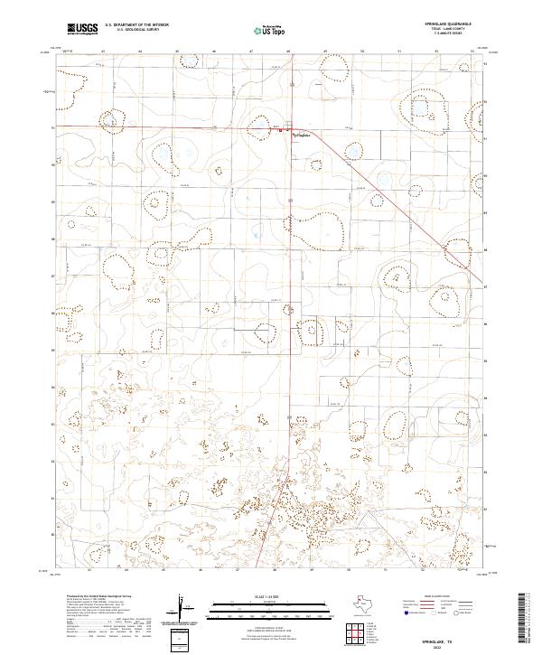
2022 Map of Springlake
USGS Topo · Published 2022About this map
Springlake and the neighboring settlement of Dent define the human landscape of this section of Lamb County. The terrain is characterized by the expansive agricultural grid of the High Plains, where a dense network of local roads such as Co RD 74 and Co RD 199 facilitates movement between farmsteads. This 2022 survey illustrates the modern configuration of the regional infrastructure, highlighting the intersection of state-maintained routes like FM 2080 and FM 302 which connect these rural communities to the wider Texas Panhandle. The landscape is dotted with numerous small depressions and natural basins typical of the Llano Estacado, providing a detailed record of the local topography and drainage patterns at the start of the 2020s.
Find a feature on this map
20 named features on this map. Tap any name to fly to it.
Don’t see what you’re looking for? This feature index may not catch every label — zoom into the map to look around manually.
Map Details
Editions of this 2022 Springlake Map
This is the sole edition of this map. No revisions or reprints were ever made.
Other maps of this area

1954 · Clovis
USGS Topo · 1:250,000

1958 · Clovis
USGS Topo · 1:250,000

1962 · Amherst
USGS Topo · 1:24,000

1962 · Cofferville
USGS Topo · 1:24,000

1962 · Springlake
USGS Topo · 1:24,000

1962 · Fieldton
USGS Topo · 1:24,000

1963 · Earth
USGS Topo · 1:24,000

1963 · Olton
USGS Topo · 1:24,000

1963 · Dodd SE
USGS Topo · 1:24,000

1963 · Dodd
USGS Topo · 1:24,000