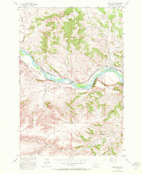
1955 Map of Springtime
USGS Topo · Published 1972About this map
The Yellowstone River cuts a wide path through this portion of Stillwater County, defining the local transport and drainage patterns in the mid-1950s. The Northern Pacific railroad runs parallel to the river's north bank, serving the small settlement of Springtime and the nearby location of Craver. To the south, the landscape is marked by deep coulees and ridges, including Haystack Coulee and Kennedy Coulee, which channel water toward the main river valley.
Find a feature on this map
19 named features on this map. Tap any name to fly to it.
Don’t see what you’re looking for? This feature index may not catch every label — zoom into the map to look around manually.
Map Details
Editions of this 1955 Springtime Map
2 editions found
Other maps of this area

1891 · Big Timber
USGS Topo · 1:125,000

1892 · Stillwater
USGS Topo · 1:125,000

1893 · Big Timber
USGS Topo · 1:125,000

1954 · Billings
USGS Topo · 1:250,000

1955 · Antelope Point
USGS Topo · 1:24,000

1955 · Sandborn Creek
USGS Topo · 1:24,000

1955 · Reed Point
USGS Topo · 1:24,000

1955 · Springtime
USGS Topo · 1:24,000

1955 · Whitebird School
USGS Topo · 1:24,000

1955 · Absarokee
USGS Topo · 1:24,000