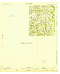
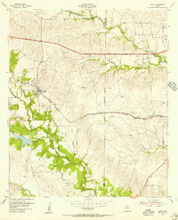
1932 Map of Springtown
USGS Topo · Published 1932About this map
The rolling hills at the junction of Wise, Parker, and Tarrant counties are meticulously documented in this 1932 edition, based on a 1924 survey. Small rural communities and rural institutions define the landscape, notably Briar, Reno, and Peden. The presence of numerous local churches such as New Hope Ch, Knob Ch, and Jaybird Ch alongside schoolhouses like Onion Hill Sch and Liberty Sch reveals a distributed network of family-centered settlements during the early 20th century.
Find a feature on this map
24 named features on this map. Tap any name to fly to it.
Don’t see what you’re looking for? This feature index may not catch every label — zoom into the map to look around manually.
Map Details
Editions of this 1932 Springtown Map
This is the sole edition of this map. No revisions or reprints were ever made.
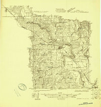
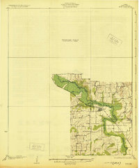
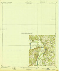
Other maps of this area

1891 · Weatherford
USGS Topo · 1:125,000

1893 · Weatherford
USGS Topo · 1:125,000

1894 · Fort Worth
USGS Topo · 1:125,000
1924 · Sunset 4-d
USGS Topo · 1:48,000
1930 · Boyd
USGS Topo · 1:62,500
1931 · Dennis
USGS Topo · 1:62,500

1954 · Dallas
USGS Topo · 1:250,000

1954 · Sherman
USGS Topo · 1:250,000
1955 · Avondale
USGS Topo · 1:24,000
1955 · Aledo
USGS Topo · 1:24,000