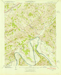
1939 Map of Springvale
USGS Topo · Published 1954About this map
The Nolichucky River carves a winding path through the borderlands of Hamblen, Cocke, and Greene Counties, defining a landscape shaped by river commerce and rail transport in the late 1930s. The Southern railroad runs parallel to the ridges of the Bays Mountains, connecting small settlements like Springvale and Susong. Civil infrastructure of the era is well-documented, from the State Fish Hatchery to the Emergency Landing Field and the Airway Beacon, reflecting the growing importance of aviation and resource management in East Tennessee.
Find a feature on this map
63 named features on this map. Tap any name to fly to it.
Don’t see what you’re looking for? This feature index may not catch every label — zoom into the map to look around manually.
Map Details
Editions of this 1939 Springvale Map
2 editions found
Other maps of this area

1883 · Morristown
USGS Topo · 1:125,000

1893 · Morristown
USGS Topo · 1:125,000

1895 · Morristown
USGS Topo · 1:125,000

1935 · White Pine
USGS Topo · 1:24,000

1935 · Rogersville
USGS Topo · 1:48,000

1935 · Tate Springs
USGS Topo · 1:48,000

1935 · Parrottsville
USGS Topo · 1:24,000

1935 · Springvale
USGS Topo · 1:24,000

1935 · Morristown
USGS Topo · 1:24,000

1935 · Russellville
USGS Topo · 1:24,000