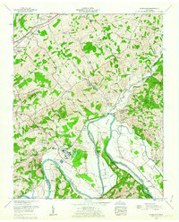
1961 Map of Springvale
USGS Topo · Published 1963About this map
The Nolichucky River and Douglas Lake define the southern landscape of this 1961 survey, where industrial and agricultural patterns meet. The presence of large-scale infrastructure is evident at Lowland, where settling basins, a pipeline, and a network of reservoirs support local operations. This industrial footprint contrasts with the older rural character of the area, marked by numerous family and community burial grounds such as Inman Cem, Enka Cem, and Forest Hill Cem.
Find a feature on this map
77 named features on this map. Tap any name to fly to it.
Don’t see what you’re looking for? This feature index may not catch every label — zoom into the map to look around manually.
Map Details
Editions of this 1961 Springvale Map
2 editions found
Other maps of this area

1883 · Morristown
USGS Topo · 1:125,000

1893 · Morristown
USGS Topo · 1:125,000

1895 · Morristown
USGS Topo · 1:125,000

1935 · White Pine
USGS Topo · 1:24,000

1935 · Rogersville
USGS Topo · 1:48,000

1935 · Tate Springs
USGS Topo · 1:48,000

1935 · Parrottsville
USGS Topo · 1:24,000

1935 · Springvale
USGS Topo · 1:24,000

1935 · Morristown
USGS Topo · 1:24,000

1935 · Russellville
USGS Topo · 1:24,000