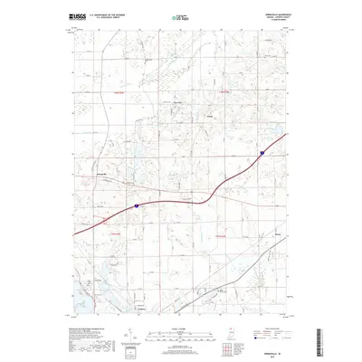
2019 Map of Springville
USGS Topo · Published 2019About this map
The Galena River and its various tributaries, such as Warwick Ditch and Moon Ditch, define the drainage patterns of this northern Indiana landscape. Small settlements and crossroads like Springville and Shippeeburg anchor the rural road grid, while the southern margin of the map shows the northern expansion of LaPorte. The land is dotted with local burial grounds, including the Rossburg Cem and the Quaker Cem, which offer significant value for genealogical research in LaPorte County.
Find a feature on this map
57 named features on this map. Tap any name to fly to it.
Don’t see what you’re looking for? This feature index may not catch every label — zoom into the map to look around manually.
Map Details
Editions of this 2019 Springville Map
This is the sole edition of this map. No revisions or reprints were ever made.
Other maps of this area

1930 · Three Oaks
USGS Topo · 1:62,500

1944 · Three Oaks
USGS Topo · 1:62,500

1953 · Chicago
USGS Topo · 1:250,000

1957 · Chicago
USGS Topo · 1:250,000

1958 · Stillwell
USGS Topo · 1:24,000

1958 · Michigan City East
USGS Topo · 1:24,000

1958 · La Porte East
USGS Topo · 1:24,000

1958 · Springville
USGS Topo · 1:24,000

1958 · New Carlisle
USGS Topo · 1:24,000
1961 · La Porte West
USGS Topo · 1:24,000