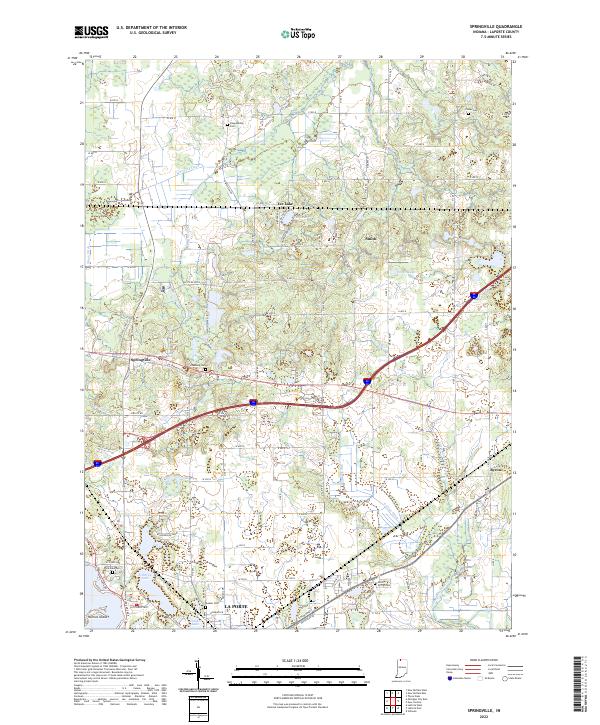
2022 Map of Springville
USGS Topo · Published 2022About this map
Springville sits at the intersection of a complex hydrological landscape where the Galena River and various man-made channels like Warwick Ditch and Moon Ditch define the local drainage. This northern Indiana survey highlights a series of water bodies including Tee Lake, Porter Lake, and Fishtrap Lake, which separate the smaller settlements from the northern edge of La Porte. The density of cemeteries such as Shippeeburg Cem, Rossburg Cem, and Quaker Cem provides a significant record for genealogical research in this rural portion of the county.
Find a feature on this map
92 named features on this map. Tap any name to fly to it.
Don’t see what you’re looking for? This feature index may not catch every label — zoom into the map to look around manually.
Map Details
Editions of this 2022 Springville Map
This is the sole edition of this map. No revisions or reprints were ever made.
Other maps of this area

1930 · Three Oaks
USGS Topo · 1:62,500

1944 · Three Oaks
USGS Topo · 1:62,500

1953 · Chicago
USGS Topo · 1:250,000

1957 · Chicago
USGS Topo · 1:250,000

1958 · Stillwell
USGS Topo · 1:24,000

1958 · Michigan City East
USGS Topo · 1:24,000

1958 · La Porte East
USGS Topo · 1:24,000

1958 · Springville
USGS Topo · 1:24,000

1958 · New Carlisle
USGS Topo · 1:24,000
1961 · La Porte West
USGS Topo · 1:24,000