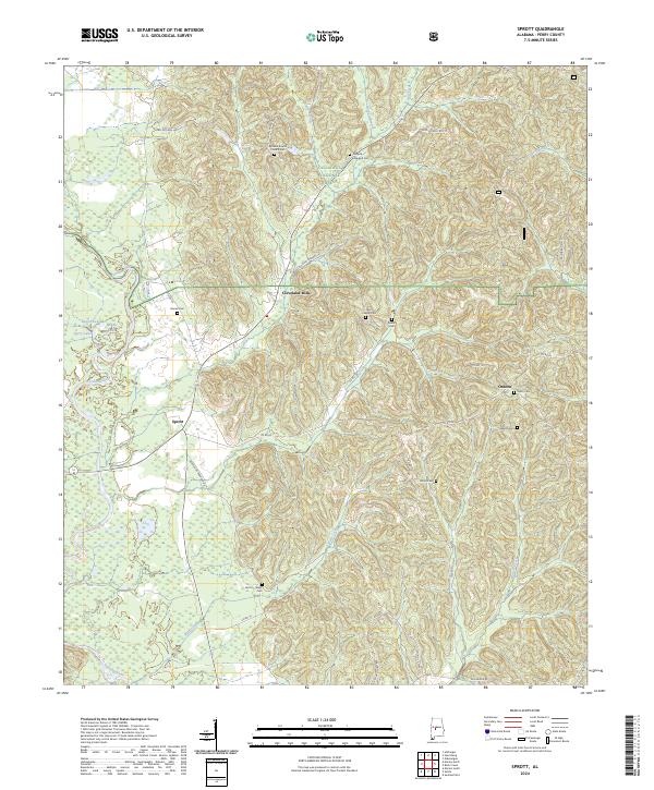
2024 Map of Sprott
USGS Topo · Published 2024About this map
The Cahaba River winds through the southwestern portion of this landscape, framing a region defined by scattered rural settlements and the dense timberlands of the Talladega National Forest. In the central portion of the map, the community of Cleveland Mills stands near the intersection of several local routes, while the crossroads at Sprott and the settlement of Osborn serve as primary anchors for the surrounding countryside. This area is notable for its high concentration of family and community burial grounds, including the Dobyne-Haggard Cem, Osburn Cem, and Farrer Cem, which provide significant points of interest for genealogical research.
Find a feature on this map
49 named features on this map. Tap any name to fly to it.
Don’t see what you’re looking for? This feature index may not catch every label — zoom into the map to look around manually.
Map Details
Editions of this 2024 Sprott Map
This is the sole edition of this map. No revisions or reprints were ever made.
Other maps of this area

1953 · Montgomery
USGS Topo · 1:250,000

1956 · Montgomery
USGS Topo · 1:250,000

1957 · Montgomery
USGS Topo · 1:250,000

1959 · Summerfield
USGS Topo · 1:62,500

1975 · Summerfield SW
USGS Topo · 1:24,000
1975 · Summerfield SE
USGS Topo · 1:24,000

1979 · Marion North
USGS Topo · 1:24,000

1979 · Marion South
USGS Topo · 1:24,000

1979 · Harrisburg
USGS Topo · 1:24,000
1980 · Oakmulgee
USGS Topo · 1:24,000