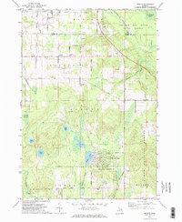
1971 Map of Spruce
USGS Topo · Published 1974About this map
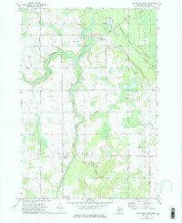
Lost Lake Woods sits at the edge of the Huron National Forest in this 1971 topographical study of northeastern Alcona County. The landscape is defined by its transition from organized farmland in townships like Caledonia and Sanborn to the dense glacial kettle lakes and wetlands of the south. The settlement of Spruce serves as a local hub, surrounded by a network of family-named roads such as La Bonte Road and Gillard Road. Evidence of the region's timber and transport history remains visible through the Old Railroad Grade winding near the eastern forest boundary. Scattered Gravel Pits suggest local industry, while numerous water bodies including Bear Lake, Deer Lake, and Badger Lake illustrate the varied terrain. Social foundations of the era are marked by the Holcomb School and the Township Cem, providing anchor points for genealogists tracing local families.
Find a feature on this map
47 named features on this map. Tap any name to fly to it.
Don’t see what you’re looking for? This feature index may not catch every label — zoom into the map to look around manually.
Map Details
Editions of this 1971 Spruce Map
2 editions found
Other maps of this area

1954 · Tawas City
USGS Topo · 1:250,000

1958 · Tawas City
USGS Topo · 1:250,000

1959 · Glennie
USGS Topo · 1:62,500

1959 · Harrisville
USGS Topo · 1:62,500

1971 · Spruce
USGS Topo · 1:24,000
1971 · Black River
USGS Topo · 1:24,000
1971 · South Point
USGS Topo · 1:24,000
1971 · Ossineke
USGS Topo · 1:24,000

1972 · Hubbard Lake
USGS Topo · 1:24,000
1972 · Big Ravine Creek
USGS Topo · 1:24,000