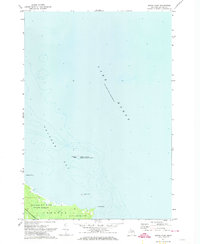
1971 Map of South Point
USGS Topo · Published 1974About this map
Michigan Islands National Wildlife Refuge and the southern shoreline of Thunder Bay define this coastal landscape on the edge of Lake Huron. The map illustrates a transitional zone where public lands and conservation efforts converge, featuring Thunder Bay River State Forest and Alpena State Park along the mainland's edge in Sanborn. This 1970s survey captures the intricate hydrography of the Great Lakes coastline, noting offshore hazards like Scarecrow Island and Bird Island. The presence of the Detroit and Mackinac railroad line running parallel to the coast highlights the transportation infrastructure necessary to serve this portion of Alpena County. From Hardwood Point to South Point, the map provides detailed bathymetric data and shoreline contours essential for understanding the maritime history and land use of the Alpena area.
Find a feature on this map
11 named features on this map. Tap any name to fly to it.
Don’t see what you’re looking for? This feature index may not catch every label — zoom into the map to look around manually.
Map Details
Editions of this 1971 South Point Map
This is the sole edition of this map. No revisions or reprints were ever made.
Other maps of this area

1954 · Tawas City
USGS Topo · 1:250,000

1954 · Alpena
USGS Topo · 1:250,000

1957 · Alpena
USGS Topo · 1:250,000

1958 · Alpena
USGS Topo · 1:250,000

1958 · Tawas City
USGS Topo · 1:250,000

1969 · Alpena
USGS Topo · 1:250,000

1971 · Alpena
USGS Topo · 1:24,000
1971 · Thunder Bay Island
USGS Topo · 1:24,000

1971 · Spruce
USGS Topo · 1:24,000

1971 · North Point
USGS Topo · 1:24,000