
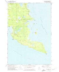
1971 Map of North Point
USGS Topo · Published 1974About this map
Thunder Bay River State Forest dominates this coastal landscape on the edge of Lake Huron, where intricate shorelines and inland wetlands define the terrain. The presence of the Baarley Landing Strip and numerous Gravel Pits suggests a mid-century balance of recreation and local industry. The map reveals a complex aquatic geography, from the larger Thunder Bay and Whitefish Bay to tucked-away features like El Cajon Bay and Misery Bay.
Find a feature on this map
27 named features on this map. Tap any name to fly to it.
Don’t see what you’re looking for? This feature index may not catch every label — zoom into the map to look around manually.
Map Details
Editions of this 1971 North Point Map
2 editions found
Other maps of this area

1954 · Tawas City
USGS Topo · 1:250,000

1954 · Alpena
USGS Topo · 1:250,000

1957 · Alpena
USGS Topo · 1:250,000

1958 · Alpena
USGS Topo · 1:250,000

1958 · Tawas City
USGS Topo · 1:250,000

1969 · Alpena
USGS Topo · 1:250,000

1971 · Alpena
USGS Topo · 1:24,000
1971 · Thunder Bay Island
USGS Topo · 1:24,000

1971 · Middle Island
USGS Topo · 1:24,000
1971 · Long Lake East
USGS Topo · 1:24,000