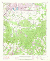
1945 Map of Spruce Pine
USGS Topo · Published 1970About this map
Russellville and its southern neighboring community of Spruce Pine define the industrial and residential landscape of this mid-century Franklin County survey. The Southern Railway corridor acts as a central spine through the terrain, passing through Gravel Hill and past a significant Strip Mine operation. The presence of Sloss Lake and numerous tailings ponds near Reedtown indicates a landscape heavily influenced by local mining and resource extraction.
Find a feature on this map
50 named features on this map. Tap any name to fly to it.
Don’t see what you’re looking for? This feature index may not catch every label — zoom into the map to look around manually.
Map Details
Editions of this 1945 Spruce Pine Map
3 editions found

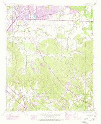
Other maps of this area

1924 · Tuscumbia
USGS Topo · 1:48,000

1925 · Barton
USGS Topo · 1:62,500

1926 · Tuscumbia
USGS Topo · 1:62,500

1926 · Barton
USGS Topo · 1:48,000

1929 · Barton
USGS Topo · 1:62,500

1936 · Russellville
USGS Topo · 1:24,000

1936 · Newburg
USGS Topo · 1:24,000

1936 · Kinlock Spring
USGS Topo · 1:24,000

1936 · Frankfort
USGS Topo · 1:24,000

1936 · Isbell
USGS Topo · 1:24,000