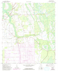
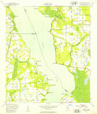
1970 Map of Spuds
USGS Topo · Published 1992About this map
Agricultural lands and wetlands dominate this 1970 landscape, where the Florida East Coast railway cuts a diagonal path through the northern reach of Spuds. This small community, situated near the headwaters of Deep Creek, reflects the rural character of St. Johns County before late-century development intensified. To the south, the settlement of Byrd serves as a local landmark near the winding course of Sixteenmile Creek, which drains toward the southwest.
Find a feature on this map
14 named features on this map. Tap any name to fly to it.
Don’t see what you’re looking for? This feature index may not catch every label — zoom into the map to look around manually.
Map Details
Editions of this 1970 Spuds Map
4 editions found
Other maps of this area

1912 · Palatka
USGS Topo · 1:48,000

1915 · Palatka
USGS Topo · 1:62,500

1937 · Elkton
USGS Topo · 1:24,000

1937 · Crescent Beach
USGS Topo · 1:24,000

1937 · Dinner Island
USGS Topo · 1:48,000

1943 · St. Augustine
USGS Topo · 1:62,500

1943 · Dinner Island
USGS Topo · 1:62,500

1944 · Dinner Island
USGS Topo · 1:62,500

1947 · Bostwick
USGS Topo · 1:50,000
1949 · Riverdale
USGS Topo · 1:24,000