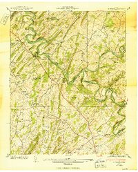
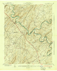
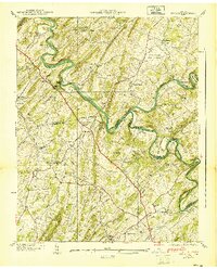
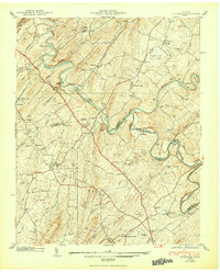
1940 Map of Spurgeon
USGS Topo · Published 1950About this map
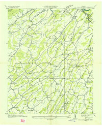
Tri-City Airport, also labeled as McKellar Field, sits at the convergence of air, rail, and river travel in this late 1930s landscape. The terrain is defined by the winding paths of the South Fork Holston River and the Watauga River, where numerous traditional crossings like Shipley Ferry, Hall Ford, and Smith Shoal Bridge facilitate local movement between Sullivan and Washington Counties.
Find a feature on this map
77 named features on this map. Tap any name to fly to it.
Don’t see what you’re looking for? This feature index may not catch every label — zoom into the map to look around manually.
Map Details
Editions of this 1940 Spurgeon Map
4 editions found
Other maps of this area

1891 · Roan Mountain
USGS Topo · 1:125,000

1892 · Greeneville
USGS Topo · 1:125,000

1894 · Roan Mountain
USGS Topo · 1:125,000

1894 · Estillville
USGS Topo · 1:125,000

1896 · Greeneville
USGS Topo · 1:125,000

1897 · Bristol
USGS Topo · 1:125,000

1902 · Bristol
USGS Topo · 1:125,000

1904 · Roan Mountain
USGS Topo · 1:125,000

1904 · Greeneville
USGS Topo · 1:125,000
1935 · Sullivan Gardens
USGS Topo · 1:24,000