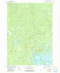
1980 Map of Squam Mountains
USGS Topo · Published 1990About this map
Squam Lake dominates the southern landscape of this New Hampshire quadrangle, its intricate shoreline dotted with family-named points and seasonal settlements like Rockywold and Deephaven. The northern reaches transition into the protected wildlands of the White Mountain National Forest, where the Sandwich Range and Squam Mountains form a formidable barrier of granite and timber. This 1980s-era survey highlights a complex network of hiking routes, including the Squam Ridge Trail and Morgan Percival Trail, which connect high peaks such as Mt Morgan and Mt Percival.
Find a feature on this map
79 named features on this map. Tap any name to fly to it.
Don’t see what you’re looking for? This feature index may not catch every label — zoom into the map to look around manually.
Map Details
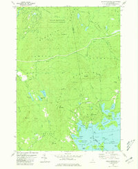
Editions of this 1980 Squam Mountains Map
2 editions found
Other maps of this area

1909 · Winnepesaukee
USGS Topo · 1:62,500

1925 · Holderness
USGS Topo · 1:62,500

1927 · Holderness
USGS Topo · 1:62,500

1928 · Plymouth
USGS Topo · 1:62,500

1931 · Plymouth
USGS Topo · 1:62,500

1931 · Mt. Chocorua
USGS Topo · 1:62,500

1949 · Portland
USGS Topo · 1:250,000

1956 · Winnipesaukee
USGS Topo · 1:62,500

1956 · Holderness
USGS Topo · 1:62,500

1956 · Portland
USGS Topo · 1:250,000