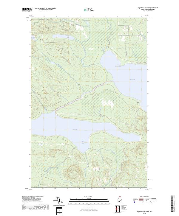
2024 Map of Square Lake West
USGS Topo · Published 2024About this map
Eagle Lake and Square Lake dominate this northern Maine landscape in the Fish River chain, where the transition from dense forest to deep water is marked by prominent shore features like The Ledge and Limestone Point. The terrain is defined by a series of drainage systems, including California Brook and Dimock Brook, which feed into the larger basins. Significant wetlands and smaller water bodies such as California Pond and Little California Pond are tucked between the ridges, illustrating the complex hydrology of Aroostook County. Access to these remote reaches is provided by Square Lake Rd and Abraham Point Rd, which skirt the edges of the timberlands. The names here, from Sly Brook Lakes to Three Brooks Cove, reflect a long-standing reliance on the local waterways for navigation and resource management in a region defined by its vast interior lakes and interconnected brooks.
Find a feature on this map
19 named features on this map. Tap any name to fly to it.
Don’t see what you’re looking for? This feature index may not catch every label — zoom into the map to look around manually.
Map Details
Editions of this 2024 Square Lake West Map
This is the sole edition of this map. No revisions or reprints were ever made.
Other maps of this area

1927 · Square Lake
USGS Topo · 1:48,000

1928 · Eagle Lake
USGS Topo · 1:48,000

1928 · Winterville
USGS Topo · 1:48,000

1929 · Portage
USGS Topo · 1:62,500

1931 · Square Lake
USGS Topo · 1:62,500

1931 · Eagle Lake
USGS Topo · 1:62,500

1931 · Portage
USGS Topo · 1:62,500

1931 · Winterville
USGS Topo · 1:62,500

1953 · Square Lake
USGS Topo · 1:62,500

1953 · Portage
USGS Topo · 1:62,500