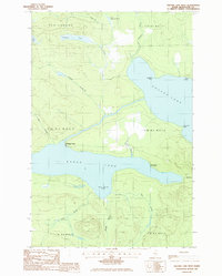
1986 Map of Square Lake West
USGS Topo · Published 1986About this map
Eagle Lake and Square Lake dominate this northern Maine landscape, connected by a narrow waterway and the historic portage point known as The Carry. This 1986 provisional survey details a region defined by its timber and recreational legacy, where named camps like Michaud Camp and landings such as Burnt Landing sit tucked along the shorelines. The topography is etched by a series of drainages, including First Brook, Middle Brook, and Last Brook, which flow through the unorganized townships of T 16 R 5 Wels and T 15 R 5 Wels. Evidence of local industry appears in the form of Gravel Pits and various campsites, reflecting the area's use for resource extraction and backcountry access. Significant landmarks like The Ledge and Abraham Point provide navigational reference in this densely wooded lake country.
Find a feature on this map
29 named features on this map. Tap any name to fly to it.
Don’t see what you’re looking for? This feature index may not catch every label — zoom into the map to look around manually.
Map Details
Editions of this 1986 Square Lake West Map
This is the sole edition of this map. No revisions or reprints were ever made.
Other maps of this area

1927 · Square Lake
USGS Topo · 1:48,000

1928 · Eagle Lake
USGS Topo · 1:48,000

1928 · Winterville
USGS Topo · 1:48,000

1929 · Portage
USGS Topo · 1:62,500

1931 · Square Lake
USGS Topo · 1:62,500

1931 · Eagle Lake
USGS Topo · 1:62,500

1931 · Portage
USGS Topo · 1:62,500

1931 · Winterville
USGS Topo · 1:62,500

1953 · Square Lake
USGS Topo · 1:62,500

1953 · Portage
USGS Topo · 1:62,500