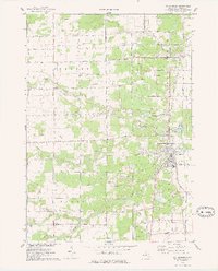
1975 Map of St. Charles
USGS Topo · Published 1978About this map
The confluence of the Shiawassee River and the Bad River anchors this 1975 survey of Saginaw County, Michigan. The village of St Charles sits at this major hydraulic junction, serving as a historic hub for the surrounding timber and agricultural lands of Fremont and Brant townships. The landscape is defined by a dense network of water management, featuring names like Smith Drain, Potato Creek, and Marsh Creek, alongside numerous sandpits and brine wells that point to the region's extractive history.
Find a feature on this map
61 named features on this map. Tap any name to fly to it.
Don’t see what you’re looking for? This feature index may not catch every label — zoom into the map to look around manually.
Map Details
Editions of this 1975 St. Charles Map
This is the sole edition of this map. No revisions or reprints were ever made.
Other maps of this area

1917 · Chesaning
USGS Topo · 1:62,500

1917 · St. Charles
USGS Topo · 1:62,500

1918 · Elsie
USGS Topo · 1:62,500

1934 · Merrill
USGS Topo · 1:62,500

1937 · Merrill
USGS Topo · 1:62,500

1943 · Chesaning
USGS Topo · 1:62,500

1943 · St. Charles
USGS Topo · 1:62,500

1943 · Elsie
USGS Topo · 1:62,500

1954 · Midland
USGS Topo · 1:250,000

1958 · Midland
USGS Topo · 1:250,000