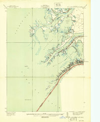
1939 Map of St. Clair Flats
USGS Topo · Published 1939About this map
Harsens Island and Dickinson Island dominate this intricate river delta landscape where the St. Clair River meets Lake St Clair. Surveyed in 1937, the map captures the unique maritime-dependent settlements of Riverside and Aloha, connected by the narrow thread of State Hy No 154 South Channel Rd. The geography is defined by a maze of waterways, including the South Channel, Middle Channel, and New Baltimore Channel, reflecting a community deeply tied to the water.
Find a feature on this map
70 named features on this map. Tap any name to fly to it.
Don’t see what you’re looking for? This feature index may not catch every label — zoom into the map to look around manually.
Map Details
Editions of this 1939 St. Clair Flats Map
This is the sole edition of this map. No revisions or reprints were ever made.
Other maps of this area

1905 · Grosse Pointe
USGS Topo · 1:62,500

1912 · Mt Clemens
USGS Topo · 1:62,500

1914 · Algonac
USGS Topo · 1:62,500

1918 · Grosse Pointe
USGS Topo · 1:62,500

1929 · Mt Clemens
USGS Topo · 1:62,500

1936 · New Haven
USGS Topo · 1:31,680

1936 · Selfridge Field
USGS Topo · 1:31,680

1936 · New Baltimore
USGS Topo · 1:31,680

1936 · Algonac
USGS Topo · 1:31,680

1939 · New Baltimore
USGS Topo · 1:24,000