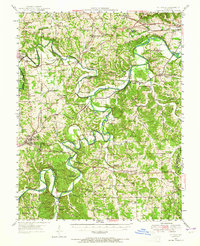
1947 Map of St. Clair
USGS Topo · Published 1965About this map
The Meramec River and Bourbeuse River dominate this 1947 landscape, their winding courses defining the borders of several townships including Boles, Central, and Calvey. This era represents a period of rural transition in Franklin County, where the sprawling Henry Shaw Arboretum stands in contrast to industrial sites like the Virginia Mines (Abandoned). The transportation network is anchored by the St Louis - San Francisco and Chicago Rock Island and Pacific railroads, which facilitated the growth of towns such as St Clair and Pacific. Local social life is evidenced by a dense network of country institutions, from the Gildehaus Sch in the north to Oklahoma Sch in the south. The map also captures distinctive landmarks like The Diamonds and the Rock Island terrain, providing a look at the mid-century settlement patterns of the Missouri Ozark foothills.
Find a feature on this map
94 named features on this map. Tap any name to fly to it.
Don’t see what you’re looking for? This feature index may not catch every label — zoom into the map to look around manually.
Map Details
Editions of this 1947 St. Clair Map
3 editions found

Other maps of this area

1890 · Hermann
USGS Topo · 1:125,000

1901 · De Soto
USGS Topo · 1:125,000

1903 · O'Fallon
USGS Topo · 1:125,000

1903 · Sullivan
USGS Topo · 1:125,000

1934 · Meramec State Park
USGS Topo · 1:24,000

1937 · Pacific
USGS Topo · 1:24,000

1937 · Fletcher
USGS Topo · 1:24,000

1937 · Meramec State Park
USGS Topo · 1:24,000

1938 · Cedar Hill
USGS Topo · 1:24,000

1938 · Fletcher
USGS Topo · 1:24,000