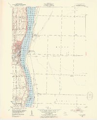
1952 Map of St. Clair
USGS Topo · Published 1954About this map
The St Clair River serves as the central artery for this international border region in the early 1950s, dividing Michigan from Ontario and connecting the Great Lakes shipping lanes. Along the western bank, the city of St Clair shows a developed waterfront where the Pine River and Belle River meet the main channel. The landscape is dotted with early educational and religious landmarks, including the Hathaway Sch and several prominent burial grounds like Hillside Cem and St Marys Cem. Across the water, the Ontario shoreline features the small settlements of Mooretown and Courtright tucked between Baby Creek and the Chesapeake and Ohio railroad. This survey also captures the recreational character of the area, noting the St Clair River Country Club and the Pine Shore Golf Course, alongside the residential growth spreading inland from the river towards Hawthorne.
Find a feature on this map
48 named features on this map. Tap any name to fly to it.
Don’t see what you’re looking for? This feature index may not catch every label — zoom into the map to look around manually.
Map Details
Editions of this 1952 St. Clair Map
2 editions found
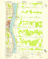
Other maps of this area

1912 · Port Huron
USGS Topo · 1:62,500

1914 · Algonac
USGS Topo · 1:62,500

1928 · Hicky
USGS Topo · 1:62,500

1929 · Port Huron
USGS Topo · 1:62,500

1936 · St. Clair
USGS Topo · 1:31,680

1936 · Rattle Run
USGS Topo · 1:31,680

1939 · Port Huron
USGS Topo · 1:24,000

1939 · St. Clair
USGS Topo · 1:24,000

1939 · Smiths Creek
USGS Topo · 1:24,000

1939 · Marine City
USGS Topo · 1:24,000