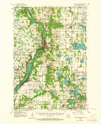
1955 Map of St Croix Dalles
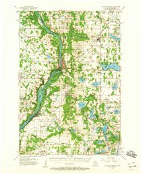
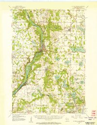
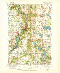
USGS Topo · Published 1964About this map
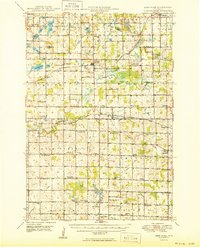
The Minneapolis St Paul and Sault Ste Marie railroad defines the corridor through St Croix Falls and Taylors Falls, where the landscape transitions from industrial rail infrastructure to the dramatic topography of Lake of the Dalles. This mid-century survey captures a network of rural communities during a period of transition, marked by the presence of the Osceola Air Force Station and the Osceola Landing Field.
Find a feature on this map
96 named features on this map. Tap any name to fly to it.
Don’t see what you’re looking for? This feature index may not catch every label — zoom into the map to look around manually.
Map Details
Editions of this 1955 St Croix Dalles Map
4 editions found
Other maps of this area

1900 · St Croix Dalles
USGS Topo · 1:62,500

1901 · St Croix Dalles
USGS Topo · 1:62,500

1948 · New Richmond
USGS Topo · 1:62,500

1948 · Stillwater
USGS Topo · 1:62,500

1949 · New Richmond
USGS Topo · 1:62,500

1949 · Stillwater
USGS Topo · 1:62,500

1950 · Rush City
USGS Topo · 1:48,000
1950 · Deer Park
USGS Topo · 1:62,500

1950 · Balsam Lake
USGS Topo · 1:62,500

1951 · Milltown
USGS Topo · 1:48,000
Featured Places
- Osceola, WI
- Town of Osceola, Osceola
- Town of Farmington, Farmington
- Franconia, Franconia Township
- Taylors Falls, MN