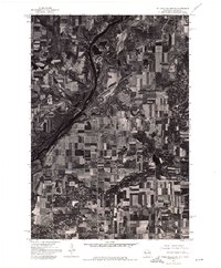
1974 Map of St. Croix Dalles SW
USGS Topo · Published 1976About this map
The Osceola and Dresser area is captured here during the mid-1970s, showcasing a landscape of intensive agricultural development along the St. Croix River valley. The aerial photography highlights the intricate geometry of farmland and woodlots that characterize this portion of Polk County. The settlement patterns of Dresser in the northeast and Osceola along the riverbanks provide a clear view of how these communities integrated with the local terrain and rail corridors during this era. This orthophotoquad preserves the exact layout of rural roads and field boundaries as they existed before decades of modern suburban expansion and changes in land use changed the local character.
Find a feature on this map
2 named features on this map. Tap any name to fly to it.
Don’t see what you’re looking for? This feature index may not catch every label — zoom into the map to look around manually.
Map Details
Editions of this 1974 St. Croix Dalles SW Map
This is the sole edition of this map. No revisions or reprints were ever made.
Other maps of this area

1900 · St Croix Dalles
USGS Topo · 1:62,500

1901 · St Croix Dalles
USGS Topo · 1:62,500

1948 · New Richmond
USGS Topo · 1:62,500

1948 · Stillwater
USGS Topo · 1:62,500

1949 · New Richmond
USGS Topo · 1:62,500

1949 · Stillwater
USGS Topo · 1:62,500

1953 · Stillwater
USGS Topo · 1:250,000

1955 · St. Croix Dalles
USGS Topo · 1:62,500

1955 · Marine
USGS Topo · 1:24,000

1955 · Forest Lake
USGS Topo · 1:62,500