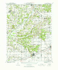
1941 Map of St. Elmo
USGS Topo · Published 1970About this map
Saint Elmo and Altamont anchor the southern portion of this mid-century landscape, serving as vital transit hubs where the Pennsylvania, Baltimore and Ohio, and Chicago and Eastern Illinois railroads converge. The industrial character of the era is evident through the presence of the Carter Refinery near the Kaskaskia River and another site by Wrights Corners. The survey details a dense network of rural infrastructure, from the Airway Beacon west of Saint Elmo to numerous country schoolhouses like Prairie Cottage Sch and Logue Sch.
Find a feature on this map
112 named features on this map. Tap any name to fly to it.
Don’t see what you’re looking for? This feature index may not catch every label — zoom into the map to look around manually.
Map Details
Editions of this 1941 St. Elmo Map
2 editions found
Other maps of this area

1941 · St. Elmo
USGS Topo · 1:62,500

1942 · Shelbyville
USGS Topo · 1:62,500

1944 · Ramsey
USGS Topo · 1:62,500

1945 · St. Elmo
USGS Topo · 1:62,500

1945 · Kinmundy
USGS Topo · 1:62,500

1945 · Vandalia
USGS Topo · 1:62,500

1946 · Shelbyville
USGS Topo · 1:62,500

1946 · Ramsey
USGS Topo · 1:62,500

1947 · Vandalia
USGS Topo · 1:62,500

1947 · Kinmundy
USGS Topo · 1:62,500