
1952 Map of St Francis 3
USGS Topo · Published 1952About this map
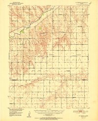
Cherry Creek Valley and the surrounding high plains of Cheyenne County are captured here during a period of established rural settlement in the early 1950s. The landscape is defined by the confluence of the South Fork Republican River and Cherry Creek, with the broad Republican River continuing northeast. The mapping reveals a dense network of one-room schoolhouses that served the agricultural community, including Mt Zion Sch, Highland Sch, and School No 65. These local landmarks, along with the Neville Ch and Battle Creek Cem, provide a precise record of the social infrastructure before the consolidation of rural districts. The terrain transitions from the river bottoms to the elevated Lawn Ridge, where numerous windmills are marked, highlighting the vital role of groundwater management for the upland farms and ranches of western Kansas.
Find a feature on this map
26 named features on this map. Tap any name to fly to it.
Don’t see what you’re looking for? This feature index may not catch every label — zoom into the map to look around manually.
Map Details
Editions of this 1952 St Francis 3 Map
2 editions found
Other maps of this area

1942 · St. Francis
USGS Topo · 1:62,500

1943 · St. Francis
USGS Topo · 1:62,500

1950 · Bonny Reservoir
USGS Topo · 1:62,500

1951 · St Francis
USGS Topo · 1:62,500

1951 · Bird City North
USGS Topo · 1:62,500

1951 · Bird City South
USGS Topo · 1:62,500

1954 · Limon
USGS Topo · 1:250,000

1954 · Goodland
USGS Topo · 1:250,000

1956 · Goodland
USGS Topo · 1:250,000

1957 · Limon
USGS Topo · 1:250,000