Loading...
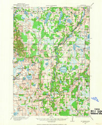
Loading map...1916 Map of St. Francis
USGS Topo · Published 1969About this map
The Rum River winds through the heart of this landscape, anchoring a rural network of small agricultural settlements and early school districts during the mid-1910s. Along its banks, Saint Francis serves as a local hub, while the Great Northern railway line to the east connects the communities of Bethel and Cedar to wider markets. The terrain is defined by a dense concentration of glacial lakes, including the large Lake George, Blue Lake, and the smaller Twin Lakes.
Find a feature on this map
71 named features on this map. Tap any name to fly to it.
Don’t see what you’re looking for? This feature index may not catch every label — zoom into the map to look around manually.
Map Details
Date Portrayed1916
Date Published1969
PublisherU.S. Geological Survey
Map TypeTopographic
Scale1:62,500
Physical Dimensions16.5 x 20.2 inches
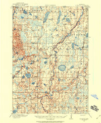
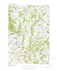
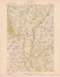
Editions of this 1916 St. Francis Map
3 editions found
Historical Maps of Andover Through Time
Featured Locations
Source Details
SourceU.S. Geological Survey
CopyrightPublic Domain