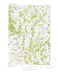
1916 Map of St. Francis
USGS Topo · Published 1962About this map
The Rum River meanders southward through this rural landscape at the border of Isanti and Anoka counties, serving as the primary drainage for a region dotted with numerous glacial lakes. Small agricultural and mill settlements such as Saint Francis and Bethel anchor the local economy, while the Great Northern Railway cuts through the eastern portion of the sheet near Cedar. The density of rural education is a striking feature of this era, with many named districts including the Dunn School, Breezy Point School, and Walker School serving dispersed farmstead families.
Find a feature on this map
76 named features on this map. Tap any name to fly to it.
Don’t see what you’re looking for? This feature index may not catch every label — zoom into the map to look around manually.
Map Details
Editions of this 1916 St. Francis Map
3 editions found
Other maps of this area

1902 · White Bear
USGS Topo · 1:62,500

1902 · Anoka
USGS Topo · 1:62,500

1909 · Rockford
USGS Topo · 1:62,500

1916 · St. Francis
USGS Topo · 1:62,500

1919 · St. Francis
USGS Topo · 1:62,500

1953 · Stillwater
USGS Topo · 1:250,000

1955 · Circle Pines
USGS Topo · 1:24,000

1955 · Anoka
USGS Topo · 1:24,000

1955 · Coon Rapids
USGS Topo · 1:24,000

1955 · Isanti
USGS Topo · 1:62,500