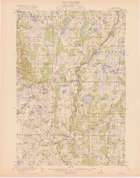
1919 Map of St. Francis
USGS Topo · Published 1919About this map
The Rum River meanders through a landscape of dense glacial lakes and early 20th-century agrarian settlements in this survey of northern Anoka County and southern Isanti County. Centered on Saint Francis, the map reveals a highly decentralized rural society organized around a dense network of one-room schoolhouses, including the Nowthen School, Lakeside School, and Baker School. The eastern corridor is defined by the Great Northern railroad, which links the village of Bethel to the surrounding township. This era precedes modern drainage and highway development, showing the original extent of wetlands and prominent water bodies like Lake George and Lake Itasca in their early surveyed state. Smaller settlements such as Crown, Nowthen, and Constance serve as local anchors for a population of farmers and homesteaders whose homesteads are situated among the intricate creek systems and numerous named basins like Pickerel Lake and Bear Lake.
Find a feature on this map
69 named features on this map. Tap any name to fly to it.
Don’t see what you’re looking for? This feature index may not catch every label — zoom into the map to look around manually.
Map Details
Editions of this 1919 St. Francis Map
2 editions found
Other maps of this area

1902 · White Bear
USGS Topo · 1:62,500

1902 · Anoka
USGS Topo · 1:62,500

1909 · Rockford
USGS Topo · 1:62,500

1916 · St. Francis
USGS Topo · 1:62,500

1919 · St. Francis
USGS Topo · 1:62,500

1953 · Stillwater
USGS Topo · 1:250,000

1955 · Circle Pines
USGS Topo · 1:24,000

1955 · Anoka
USGS Topo · 1:24,000

1955 · Coon Rapids
USGS Topo · 1:24,000

1955 · Isanti
USGS Topo · 1:62,500