
1933 Map of St Francis
USGS Topo · Published 1933About this map
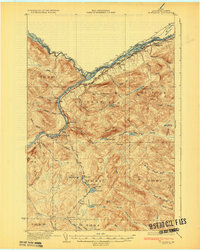
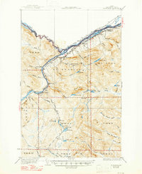
The St John River carves a deep border through the northern woods of Aroostook County, defining the international boundary between Maine and Canada. This 1930s survey documents a landscape where timber and transport dominate, anchored by the Bangor and Aroostook railroad line running parallel to the water through St John and Bradbury. Small centers of rural life like St Francis and the Back Settlement are shown with their proximity to local resources, including Jones Mill and several isolated schoolhouses such as McKinley Sch and Lincoln Sch.
Find a feature on this map
82 named features on this map. Tap any name to fly to it.
Don’t see what you’re looking for? This feature index may not catch every label — zoom into the map to look around manually.
Map Details
Editions of this 1933 St Francis Map
3 editions found
Other maps of this area

1928 · Eagle Lake
USGS Topo · 1:48,000

1928 · Winterville
USGS Topo · 1:48,000

1930 · Allagash
USGS Topo · 1:48,000

1930 · St Francis
USGS Topo · 1:48,000

1931 · Fish River Lake
USGS Topo · 1:48,000

1931 · Eagle Lake
USGS Topo · 1:62,500

1931 · Winterville
USGS Topo · 1:62,500

1932 · Fort Kent
USGS Topo · 1:48,000

1932 · Allagash Falls
USGS Topo · 1:48,000

1933 · Allagash
USGS Topo · 1:62,500