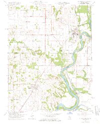
1964 Map of St. Francisville
USGS Topo · Published 1966About this map
The Wabash River creates a meandering border between Lawrence County, Illinois, and Knox County, Indiana, defining the geography of this mid-1960s survey. At the center of this river-driven landscape sits St Francisville, where a dense street grid meets the riverbank at Catfish Bend. The New York Central railroad cuts diagonally across the terrain, linking the river town to Allendale and smaller clusters like Adams Corner.
Find a feature on this map
35 named features on this map. Tap any name to fly to it.
Don’t see what you’re looking for? This feature index may not catch every label — zoom into the map to look around manually.
Map Details
Editions of this 1964 St. Francisville Map
3 editions found
Other maps of this area

1901 · Princeton
USGS Topo · 1:62,500

1903 · Princeton
USGS Topo · 1:62,500

1903 · Patoka
USGS Topo · 1:125,000

1904 · Mount Carmel
USGS Topo · 1:62,500

1911 · Sumner
USGS Topo · 1:62,500

1913 · Sumner
USGS Topo · 1:62,500

1915 · Vincennes
USGS Topo · 1:62,500

1944 · Vincennes
USGS Topo · 1:62,500

1956 · Vincennes
USGS Topo · 1:250,000

1957 · Vincennes
USGS Topo · 1:250,000