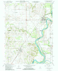
1964 Map of St. Francisville
USGS Topo · Published 1984About this map
The Wabash River serves as a winding border between Illinois and Indiana, defining the geography of this 1960s survey. On the Illinois side, the riverbank is marked by the community of St Francisville and the sandy reaches of the Sand Barrens. The New York Central railroad cuts a diagonal path through the landscape, connecting the agricultural hub of Allendale and the rural crossroads of Adams Corner to the regional network.
Find a feature on this map
46 named features on this map. Tap any name to fly to it.
Don’t see what you’re looking for? This feature index may not catch every label — zoom into the map to look around manually.
Map Details
Editions of this 1964 St. Francisville Map
3 editions found
Other maps of this area

1901 · Princeton
USGS Topo · 1:62,500

1903 · Princeton
USGS Topo · 1:62,500

1903 · Patoka
USGS Topo · 1:125,000

1904 · Mount Carmel
USGS Topo · 1:62,500

1911 · Sumner
USGS Topo · 1:62,500

1913 · Sumner
USGS Topo · 1:62,500

1915 · Vincennes
USGS Topo · 1:62,500

1944 · Vincennes
USGS Topo · 1:62,500

1956 · Vincennes
USGS Topo · 1:250,000

1957 · Vincennes
USGS Topo · 1:250,000